Mount Zermula and Zuc della Guardia, two of the most famous sites in Friuli Venezia Giulia, rise above the Cason di Lanza Pass and can be reached via two via ferratas.
The route begins by leaving the car at the parking area of the aforementioned pass, then continuing past the refuge of the same name (1552 m) and taking CAI trail 442, which, heading to the right, allows you to circle around the base of Mount Zermula.
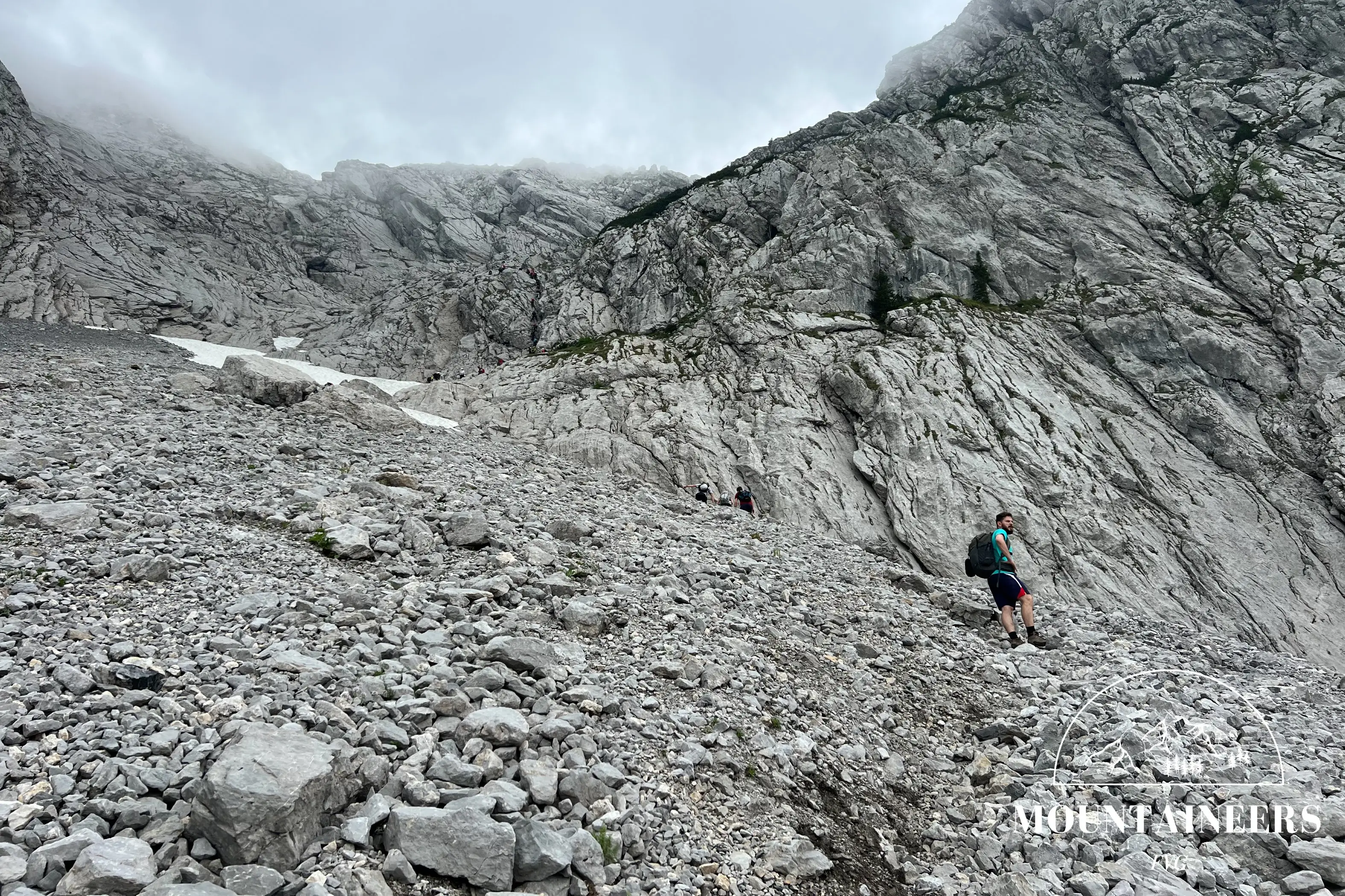
Continuing on this trail, which gradually changes from forested landscape to mostly rocky terrain, after about 45 minutes of walking you reach the start of the via ferrata, which continues up to just below the summit of the mountain. This section of the route, to be tackled with harnesses, does not require excessive eƯort, except for some stretches that are nearly vertical or particularly exposed. From this point onward, you can begin to enjoy the panorama, thanks to the absence of visual cover from the vegetation.
The summit (2143 m) is reached in about an hour and a half from the start of the via ferrata; from here you can admire a magnificent view of the Creta di Aip and Mount Cavallo di Pontebba to the northeast, while on the southwest side you can spot the town of Paularo.
From there, continue along trail 442, where you can choose between two options to continue the hike: the first takes you along the trenches of the First World War, where you will be fascinated by the mastery in building fortifications that, more than a hundred years ago, already belonged to military engineering; alternatively, the second option is to follow the normal route of Mount Zermula. This latter option, no less engaging than the first, allows you to skirt the mountain on the opposite side from the ferrata.
Continuing on the normal route for half an hour, you reach another key point of the trail, the Forca di Lanza (1831 m). With a further 25 minutes of walking, mostly downhill together with the section towards the pass, you reach the start of the second via ferrata, that of Zuc della Guardia. This one, lasting about 20 minutes, continues up to the summit (1911 m), from which there is a good view towards the south/southeast of Mount Pizzul (1985 m) and Zuc di Malaseit (1829 m). With another half hour of walking you then reach the start of CAI trail 442a, which leads back to the initial parking area.
As for this second ferrata, it is technically easier than the previous one on the ascent, although it does have points that require attention, given that most of the route is downhill.
Following trail 442a for about 25 minutes, the hike ends with the descent back to the Cason di Lanza Pass, where you can rest at the refuge before retrieving your car from where you left it.
References
Photo/video galleryDISCLAIMER: The information provided herein is based on the personal experience of the page editors, and as such should be taken with a grain of salt: it may not be up to date or accurate. The editors strongly recommend always checking the condition of the trails with the relevant authorities before setting out on a hike.