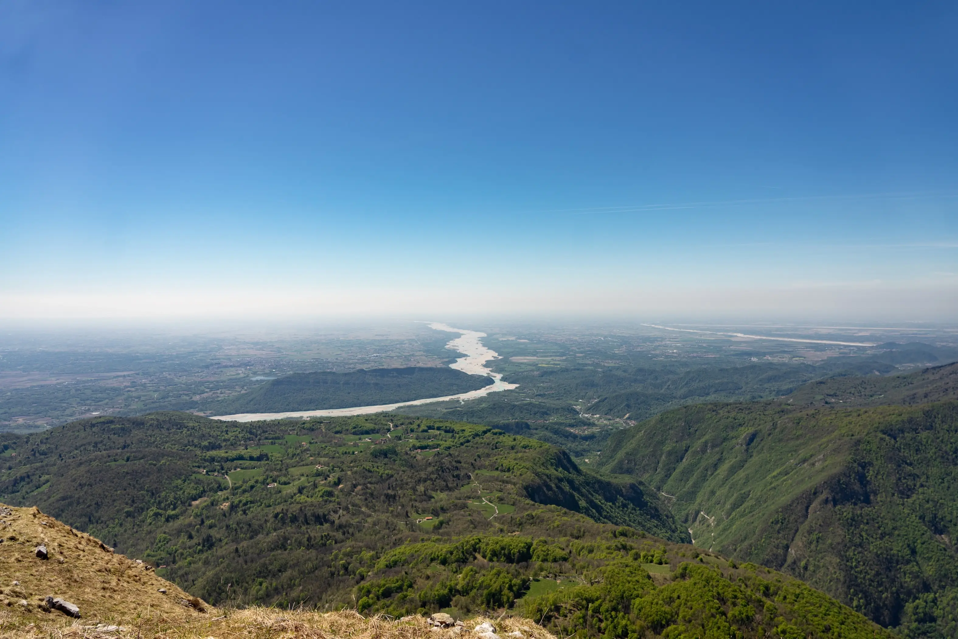
Monte Cuar (Friulian for “horn”, due to the shape of its summit) is one of the lower mountain formations west of the Tagliamento River, yet it offers evocative views over the Gemona section of the river.
From Avasinis, you reach the locality “La Forcje”, where you can park your car. From here, take trail CAI 816 (815a), which in about one hour leads from Cuel di Forchia (894 m) to Monte Cuar. Once at the summit (1478 m), follow CAI 815 for about 30 minutes along the descending ridge to Cuel dai Poz (1377 m).
Skirting this secondary peak, the trail descends into Val dai Poz, reaching the Malga Cuar shelter. From here, CAI 815 gently descends the entire northern slope, bringing you back to the starting point at Forchia in about 1h15.
Advises
Scarsa disponibilità di parcheggi, si consiglia di raggiungere il luogo nella prima mattinata. Portare sempre con se la crema solare, a fine camminata sarete felici di averla messa.
In case of snow, ice or adverse weather conditions, pay close attention to the road, which is very narrow and full of hairpin bends without external protections.
References
Photo/video galleryDISCLAIMER: The information provided herein is based on the personal experience of the page editors, and as such should be taken with a grain of salt: it may not be up to date or accurate. The editors strongly recommend always checking the condition of the trails with the relevant authorities before setting out on a hike.